What PCH Actually Covers - and Where It Gets Complicated
Most people imagine PCH as a continuous oceanfront ribbon from Los Angeles to San Francisco. The reality is more fragmented. Highway 1 does trace the coast for long stretches, but it merges into US-101 around Leggett in the north and near Gaviota in the south. In the Los Angeles area, the segment most people call "PCH" runs from Santa Monica up through Malibu - that section is genuinely coastal and relatively straightforward to drive.
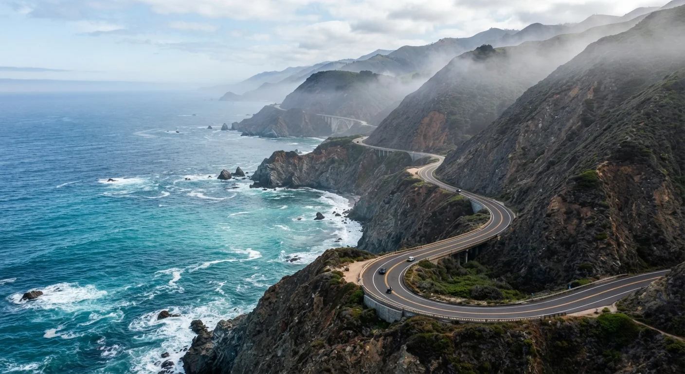
The section between San Luis Obispo County and Monterey County - the Big Sur coast - is where the road becomes genuinely demanding. Two lanes, no guardrail on many curves, steep drop-offs, and limited pullouts. It's stunning, but it requires full attention. This is also the segment most often closed due to landslides or storm damage; Caltrans maintains a real-time road conditions map that should be your first check before any Big Sur leg.
If you're planning a longer coastal trip, see our guide to scenic byways vs. interstates for a framework on when choosing a byway like PCH actually makes sense given your timeline and tolerance for detours.
PCH Is a State Highway, Not a Federal Scenic Byway
Although sections of Highway 1 overlap with designated scenic byways, PCH itself is a California state route maintained by Caltrans. This means road conditions, closures, and improvement timelines are managed at the state level. The federal America's Byways program designates separate routes, some of which share mileage with Highway 1 but are not identical to it.
Realistic Speed and Timing Expectations
Google Maps will estimate the Los Angeles to San Francisco drive via Highway 1 at around 9 hours. Budget at least 12-14 hours of actual drive time if you plan any stops - and most people do, because stopping is the point. On Big Sur, a 90-mile stretch can easily consume three to four hours once you factor in pullouts, one-lane bridge crossings, and the occasional herd of cattle crossing the road.
Summer weekends around Carmel, Big Sur, and Malibu see significant congestion. Parking at landmark viewpoints like McWay Falls or Bixby Creek Bridge can involve waiting. If you're driving in peak season and want to move efficiently, an early morning start - on the road before 8 a.m. - makes a noticeable difference.
655 mi
Total length of California State Route 1
Highway 1 runs from Dana Point in Orange County to Leggett in Mendocino County, though it merges with US-101 in multiple places.
90 mi
Length of the Big Sur coastal stretch
The Big Sur segment between Cambria and Carmel is the most dramatic and most closure-prone portion of the highway.
3-4 hrs
Realistic driving time through Big Sur
Despite being under 100 miles, the Big Sur section averages 25-30 mph due to curves, traffic, and frequent stopping points.
Sections Worth Prioritizing (and One You Can Skip)
Big Sur (Cambria to Carmel): The non-negotiable section. If you only drive one part of Highway 1, this is it. Julia Pfeiffer Burns State Park, Pfeiffer Beach, and the Bixby Creek Bridge are all here. Plan a full day for this segment alone.
Malibu to Santa Barbara: Accessible, genuinely coastal, and manageable in half a day. Good entry point for first-time PCH drivers. Beaches are accessible and the road is wide enough to relax on.
Monterey to Santa Cruz: Underrated. The 17-Mile Drive near Pebble Beach requires a small entry fee but offers a concentrated coastal loop. Moss Landing and the Elkhorn Slough area offer a quieter, more naturalistic experience than the tourist-heavy sections further south.
Bodega Bay to Leggett (North of San Francisco): Rugged, less-visited, and logistically challenging. Gas stations are rare. Cell service is unreliable. It's genuinely remote - which some drivers find rewarding and others find stressful. Know your vehicle's range before this stretch. For more on preparing for remote driving conditions, our cross-country drive planning guide covers fuel and supply logistics in detail.
Weather, Closures, and Conditions to Know
PCH's most scenic sections are also its most weather-exposed. Coastal fog is common in June and July - a phenomenon locals call "June Gloom" - which can reduce visibility and make the famous views disappear entirely. March through May and September through October generally offer clearer skies and thinner crowds.
Landslides are a recurring issue, particularly in Big Sur. In recent years, significant slide events have closed the highway for months at a time. These closures can force substantial inland detours via US-101. Always check the Caltrans QuickMap or the District 5 road conditions page before driving south of Carmel or north of San Simeon.
For a broader look at when to drive which California region based on seasonal conditions, the regional weather windows guide is a useful reference before you finalize dates.
Check Caltrans Before Every Big Sur Leg
Landslide closures on Highway 1 can appear with little warning and last weeks or months. Before any drive through Big Sur, check the Caltrans QuickMap or call the District 5 information line. Building a US-101 alternate route into your plan is a smart hedge, especially outside of summer's drier months.
Practical Logistics: Fuel, Food, and Cell Service
Gas is expensive along Highway 1 relative to California's already-high statewide average, and in Big Sur, stations are extremely limited. Fill your tank in Cambria heading north, or in Carmel heading south. Do not assume you can top off wherever convenient.
Food options in Big Sur are limited and closures happen seasonally. The Esalen Institute, Nepenthe restaurant, and Big Sur Bakery are landmarks, but hours and availability shift. Pack provisions if you're planning a full day through the corridor.
Cell service drops out reliably through Big Sur and parts of the Sonoma and Mendocino coasts. Download offline maps before departure - Google Maps and Apple Maps both support offline areas. If you're driving solo, let someone know your route and estimated check-in points. Our solo road trip guide covers safety planning for exactly this kind of remote coastal driving.